MARINE POSITIONING & ORIENTATION
iPos MS.
A direction for
every survey.
Integrated GNSS and inertial navigation for vessel positioning, attitude and heading. Built around the needs of your survey system.
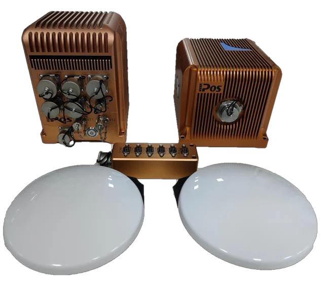 SYSTEM ARCHITECTURE / iPos MS11
SYSTEM OVERVIEW
Three elements. One navigation system.
A deck unit, an inertial measurement unit and two GNSS antennas form the system architecture. The final supply configuration is agreed for your project.
Deck unit
Navigation processing connects inertial and GNSS observations with the outputs your survey workflow requires.
Inertial measurement unit
Gyroscopes and accelerometers provide inertial measurements as part of the integrated solution.
Dual GNSS antennas
Satellite observations contribute positioning and heading information. Antenna layout is part of the installation review.
Conceptual data flow, not a wiring diagram. Physical interfaces, connections, software and included accessories are confirmed for the selected configuration.
MS11 / MS12 / MS13
Choose against the conditions that matter.
Model selection should consider GNSS conditions, required attitude and heading performance, antenna baseline and integration constraints together.
| Selection item | iPos MS11 | iPos MS12 | iPos MS13 |
|---|---|---|---|
| System architecture | Deck unit + IMU + dual GNSS antennas | ||
| Application review | Vessel positioning, orientation and hydrographic survey integration | ||
| Performance selection | Request a configuration-specific MS11 specification | Request a configuration-specific MS12 specification | Request a configuration-specific MS13 specification |
| Installation review | Antenna baseline, mounting, power, interfaces and synchronization | ||
| Next step | Discuss MS11 | Discuss MS12 | Discuss MS13 |
INTEGRATION FIRST
Connect the details
before the hardware.
Tell us what is already in your system. We can assess the connection requirements and identify the information needed to proceed.
- 01
Equipment & software
Survey equipment model, acquisition software and intended data workflow.
- 02
Interfaces & timing
Required protocols, data rates, synchronization and coordinate conventions.
- 03
Mechanical & electrical
Space, mounting, power supply, environmental conditions and cable routing.
- 04
Installation geometry
Antenna baseline, IMU location and the relative positions of survey sensors.
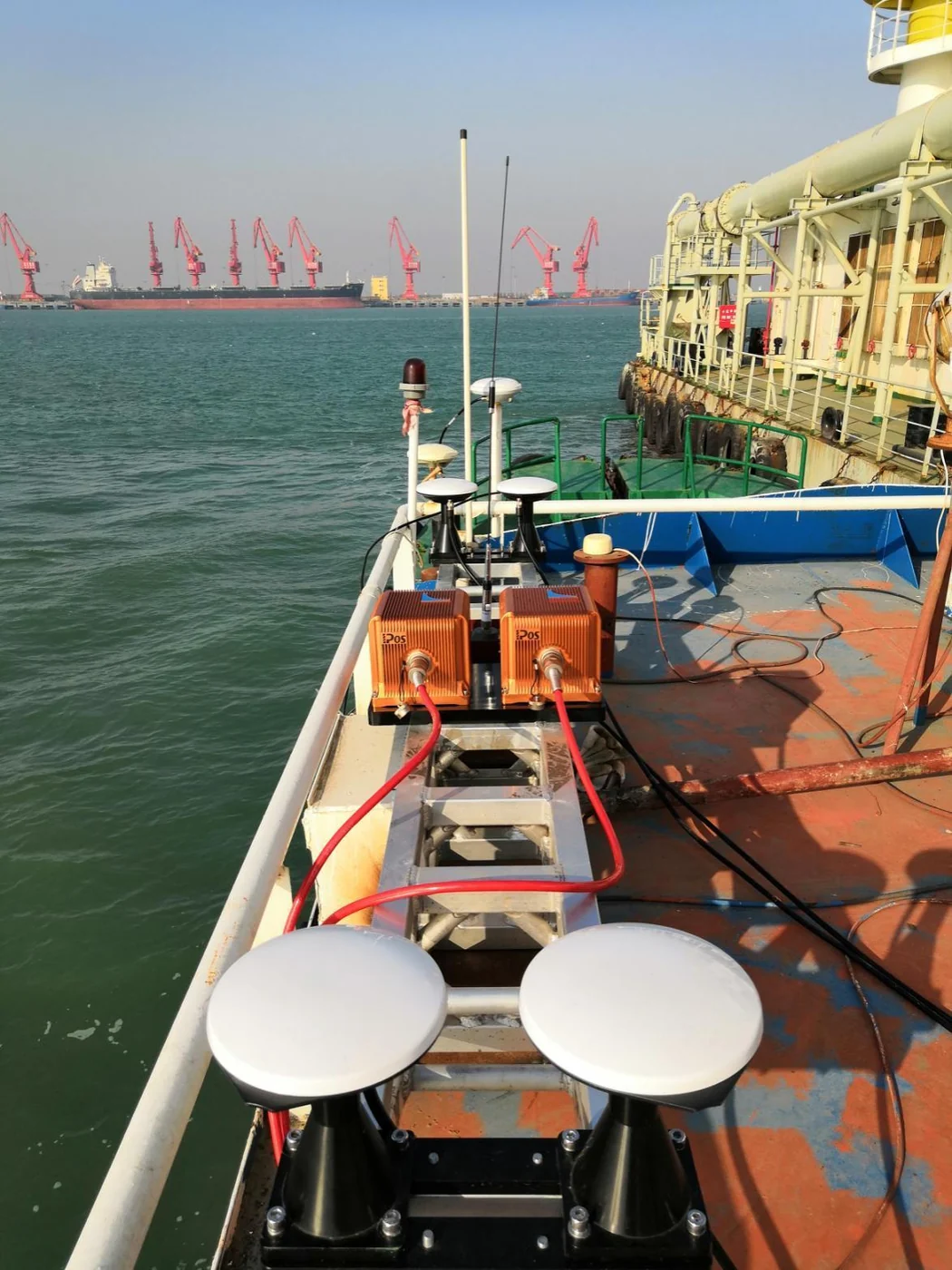
IN A LARGER MEASUREMENT SYSTEM
Made relevant
by the application.
Explore vessel installations and survey environments from the field reference material, then discuss how your system requirements compare.
SUPPLY & SUPPORT
Plan the whole integration.
Plan ahead.
Reference lead time is approximately 60 days. Configuration, start date and shipping arrangements are confirmed with your quotation.
Work through the setup.
Coordinate remote video support and training. On-site work can be arranged with travel and service terms agreed separately.
Request the right details.
Ask for the available specification and installation information for your intended model and configuration.
Request product informationCOMMON QUESTIONS
Before you specify.
Which iPos MS model should I choose?
Start with the required position, roll, pitch and heading performance, your GNSS conditions, antenna layout and survey equipment. We can review MS11, MS12 and MS13 options against those requirements.
What is included in the system?
The system architecture includes a deck unit, an IMU and two GNSS antennas. Cables, software, receiver configuration and other options are confirmed in the project quotation.
Can you assess integration with my survey equipment?
Yes. Share the equipment and software models, required outputs, interfaces and timing requirements. Compatibility and any adaptation work are evaluated for the specific configuration.
What lead time should I plan for?
The reference lead time is approximately 60 days. The start date, configuration, shipping arrangements and delivery schedule are confirmed in the quotation or order.
Is installation or training support available?
Remote video assistance and training can be coordinated. On-site support can be arranged by project; travel expenses and any engineering service fees are agreed separately.
Tell us about your project.
Start with what you know. We can work through the details together.
Use this form to prepare an email to sales@raysennav.com. You’ll review and send it from your email app.